Gloucester to Sharpness Canal Walk, Gloucestershire
The Gloucester to Sharpness Canal is a fantastic walk and off-road cycling route through some amazing Gloucestershire countryside. Hikers can choose to walk from either end of the canal or choose to walk along a small section.
Gloucester to Sharpness Canal

The Gloucester & Sharpness Canal used to be the widest and deepest in the world. Thus, the waterway is a unique place to navigate on foot or by boat. It is 16 miles long with many swing bridges and a lock in Gloucester docks.

The swing bridges combined with houses for the bridge keepers add to the charm of the walk. They constructed this canal to enable boats to bypass the treacherous stretch of the River Severn downstream of Gloucester.
The canal has many splendid views on the 16/18 mile stretch, including the Historic Docks in Gloucester, river views and panoramic views of the Cotswold Hills. The Canal & River Trust manages the towpaths and waterways.
Getting to Sharpness
Getting a lift and walking back is the easiest option; otherwise, you need to navigate the rural bus routes. Depending on the time of day, it depends on which bus route you take. These are long journeys either way, with additional walking from Berkeley to Sharpness Docks. The safest bet is to consult Google Maps the day before.
Alternatively, it is easier to start somewhere with more regular buses, like Frampton on Severn. Then walk from there. However, you may wish to double back to the Boat Graveyard if starting in Frampton.
Walking Maps
Significant Spots on the walk
These are key highlights of the hike along the canal. The rest of the walk is pure countryside with superb views and an opportunity to see local wildlife if lucky, especially near to WWT Slimbridge.
Sharpness Docks The Start of the Walk


This is where the canal meets the Bristol Channel/River Severn. It is a fully working dock with dockyards and pubs for a dose of B vitamins. Sharpness is well worth a look around, specifically in the docks and the banks of the River Severn. There is also a big lock that ships get from the river onto the canal here. This is rather impressive. A 360-degree aerial shot is on Google Maps here.
The Boat Graveyard at Purton
Purton is a small village very close to the River Severn and has some interesting sites nearby. The two low canal bridges for starters and the pretty Church of St John the Evangelist. They built this church in 1874 with its unique design.


Purton is also home to the remnants of the Severn railway crossing. You can see some ruins from the towpath. Finally, the village is home to the Purton Barge Graveyard. This is where they used it as a graveyard for old boats to prevent erosion of the banks. The graveyard first started in 1909. This is a great place for a wander and also to take some photographs.
Views over WWT Slimbridge

The canal passes WWT Slimbridge, a fantastic attraction. Slimbridge is the home of many species of wildfowl and migratory birds. It’s also a conservation centre with a variety of species that call it home. The countryside in the area is quiet farmland and very nice to see. When you reach Patch Bridge in Slimbridge, there is a pub called the Tudor Arms, a nice place for a cider or lunch out.
Frampton on Severn Church

The church at Frampton on Severn is visible from the towpath; however, you can cross a bridge nearby to have a mooch around. This church dates back to the 12th century; they consecrated it in 1315. The area surrounding the church is beautiful. While walking from the church to the bridge in the village, the views of the Severn estuary are fantastic.
Frampton on Severn Village Green

They say the village green in Frampton on Severn is the longest in the county. Popping into the village is a worthwhile detour off the route. There are some very nice village pubs, latkes on the green and old houses. Aso Frampton Court is a stunning backdrop just off the green.
Saul Junction
Saul Junction is, as it says on the tin, a canal junction which connects to the Stroudwater Navigation. This, however, is another great walk through some stunning countryside to Stonehouse.

Saul Junction is quite a picturesque place with many colourful narrowboats moored up. There is also the Stables Cafe, a great place for lunch or a hot drink.
The Pilot Inn, Hardwicke
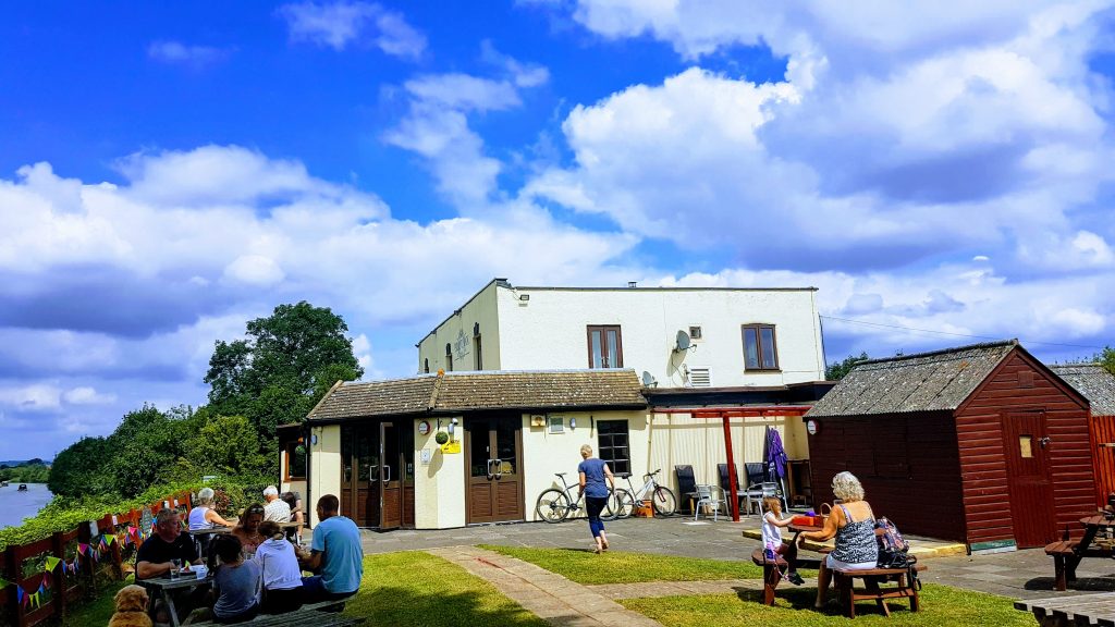
The only pub actually visible from the canal towpath is the Pilot Inn, making it an ideal spot for a break and rest your legs. They serve a selection of beers and ciders and have a decent chef creating nice food. They have inside seating but also a very popular beer garden overlooking the water. Being a country pub, they welcome dogs in the bar and garden.
Gloucester Docks

Gloucester Docks is where the canal meets the River Severn again. Boats can access via the lock. They made the docks up of historic Victorian warehouses and an interesting place to explore. There are many places to eat out or have a post-hike pint here. However, if you are hiking with the dog, there are some dog-friendly pubs in the docks.
Things to see in Gloucester after finishing include the stunning cathedral with over 1000 years of history. The docks have a few museums. The most relevant to the route is the British Waterways Museum.
Camping en route on the Gloucester-Sharpness Canal
Some may fancy turning this into a camping and hiking break to enjoy the route at a more leisurely pace. There are a few options for camping near to the towpath, the main one being Tudor Caravan Park, which has pitches for tents near to Patch Bridge in Slimbridge. They are a dog-friendly campsite with amenities. They have fast Wi-Fi and a shower block, to name a few of their facilities.
Shorter Version

To make the walk less of a challenge, hiking from Sharpness to Hardwicke is a viable option. The village has a very regular bus service to Gloucester Docks. This shaves the least attractive part of the walk off and takes nearly 5 miles off the hike.